

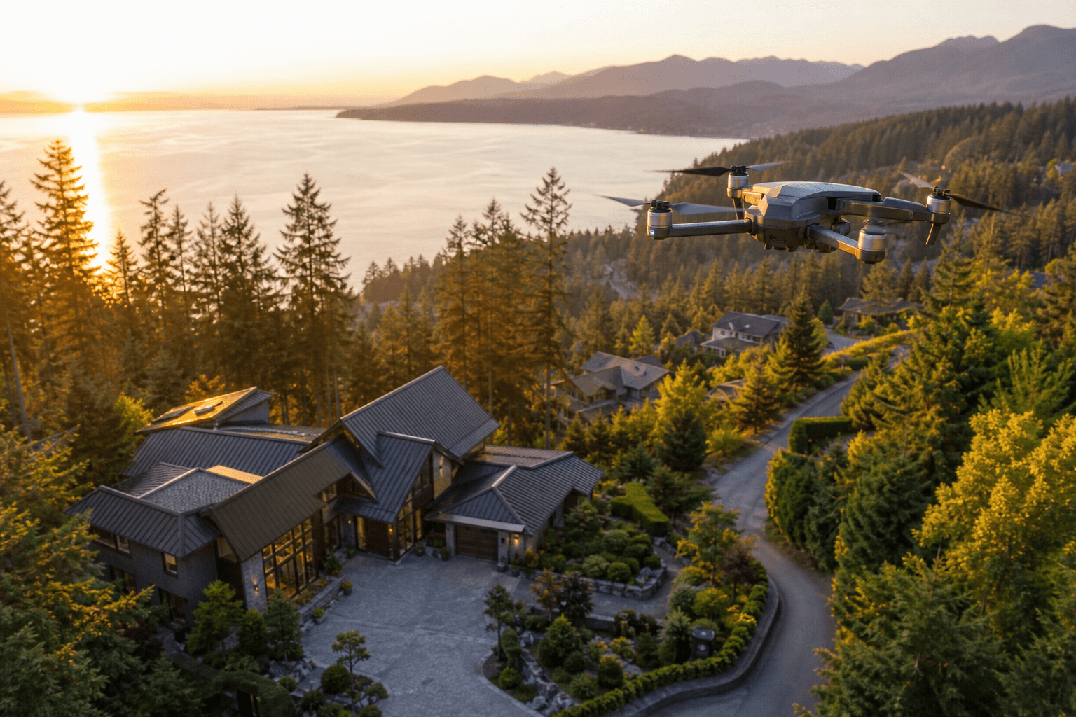
Effective drone aerial videography is not about collecting the most dramatic movements. It is about choosing a viewpoint that helps the viewer understand a property, place, product, or experience. A reveal can establish setting, an orbit can show relationships around a subject, and a ground-level transition can explain details that aerial footage cannot.
The strongest results usually come from treating aerial footage as one part of a visual story. For real estate, that may mean showing the neighbourhood and lot before moving indoors. For a restaurant, brand, event, or commercial space, it may mean using a short aerial opening before ground-based footage introduces people, atmosphere, or detail.
Quick summary

- Choose each movement for a clear purpose, such as location, scale, access, or context.
- Plan the sequence before flying instead of improvising unrelated manoeuvres.
- Check terrain, obstacles, weather, other aircraft, restrictions, permissions, bystanders, and privacy concerns.
- Combine aerial footage with ground video when the story needs interiors, close-ups, people, or sound.
- Edit selectively and prepare versions that suit listings, websites, social media, or commercial campaigns.
Drone aerial videography techniques and what each shot communicates
Aerial movements communicate different types of information. Before choosing a technique, ask what the viewer needs to learn. Is the goal to understand where a property sits, see the full grounds, appreciate its architecture, follow an approach route, or feel the atmosphere of a location?
| Technique | What it communicates | Useful applications | Common mistake |
|---|---|---|---|
| Establishing shot | Where the subject is and what surrounds it | Listings, resorts, commercial properties, events | Holding a wide view without directing attention to the subject |
| Reveal | A subject gradually appears behind a foreground element or landscape | Architecture, entrances, waterfronts, branded locations | Moving too quickly or hiding the subject for too long |
| Orbit | How a building, feature, or location relates to its surroundings | Distinctive homes, large grounds, venues, exterior design | Repeating the same view without a story reason |
| Pullback | Scale, setting, and the wider relationship between subject and environment | Acreage, neighbourhood context, commercial sites | Pulling away so far that the main subject loses meaning |
| Top-down view | Pattern, layout, shape, and spatial relationships | Driveways, pools, landscaping, event layouts | Using an abstract view that does not help the viewer decide anything |
| Tracking shot | Movement through or alongside a place | Approaches, roads, building exteriors, activity-based brands | Following motion without a clear subject or direction |
An establishing shot often works best as an opening because it answers the viewer's first question: where is this? A reveal adds interest, while an orbit or pullback can explain scale. Top-down views are most useful when layout matters, rather than simply because they look different.
For a deeper look at planning, shot selection, and editing, read this guide to drone aerial photography. The same principles apply to moving footage: every shot should contribute context, direction, or an emotional impression.
How to plan a coherent aerial video sequence

Capture technique and storytelling technique are related, but they are not the same. A smooth orbit may be well executed and still be unnecessary if it does not help the viewer understand the subject. Plan the order of information first, then choose the movement that communicates it most clearly.
A practical five-part sequence
- Establish the setting. Begin with a measured view of the property, business, venue, or surrounding area. Keep the subject recognisable.
- Reveal the main subject. Use a reveal, approach, or controlled rise to direct attention to the building, entrance, landscape, or defining feature.
- Show access and relationships. Demonstrate how the subject connects to a driveway, road, outdoor area, neighbouring context, or customer entrance.
- Highlight one meaningful feature. Choose a pool, terrace, roofline, grounds, storefront, event layout, or architectural detail that supports the purpose of the video.
- Close with direction. Finish with a clean wide view, a transition toward the entrance, or a shot that naturally leads into ground footage and the next action.
For a real estate listing, the sequence may move from neighbourhood context to the home, grounds, outdoor features, and then an interior walkthrough. For a restaurant, aerial footage may be limited to location and approach, followed by ground shots of the exterior, dining room, food, staff, and atmosphere.
Pre-flight planning: safety, environment, and privacy
Good drone videography begins before the aircraft leaves the ground. Transport Canada's current guidance advises pilots to account for terrain, obstacles, weather, other aircraft, applicable Canadian Aviation Regulations, and area-specific restrictions or requirements. Urban environments can add command-and-control challenges, particularly where buildings and streets create dense corridors. See the practical planning advice in this drone aerial view guide before finalising a shot list.
Pre-flight checklist
- Location: Identify buildings, trees, wires, towers, roads, slopes, water, and other obstacles.
- Environment: Consider weather, visibility, wind, changing light, and density of development.
- Airspace: Check current requirements and restrictions for the area.
- Other aircraft: Maintain awareness of surrounding airspace and plan a response if another aircraft appears.
- People and property: Establish where crew, clients, bystanders, vehicles, and neighbouring properties are located.
- Permissions: Confirm access to launch and landing areas and obtain relevant property permissions.
- Privacy: Avoid unnecessary capture of identifiable people, faces, licence plates, or private activity.
- Shot order: Decide the route, starting position, subject, direction, and stopping point for each movement.
Transport Canada's privacy guidance notes that personal information can include a person's face or licence plate. Respect privacy, avoid capturing people without consent, and use current official guidance when filming homes, businesses, public areas, or identifiable individuals.
When to combine drone footage with ground-based video
Aerial video is strong at showing place, scale, access, and setting. Ground-based cinematography is stronger for interiors, finishes, products, people, close details, and audio. Combining drone videography and regular video lets an edit move from broad context into human-scale detail.
For a property tour, an aerial opening can show the neighbourhood relationship, lot, or approach. The edit can then move to a ground-based entrance shot, a stabilised interior walkthrough, close views of materials, and spoken or natural sound. Aerial footage alone cannot explain room flow, lighting, cabinetry, or the feeling of moving through the home.
The same principle applies outside real estate. A restaurant may use aerial footage to show its setting and arrival route, then rely on ground video for food preparation, plating, guests, and ambience. A business brand may use a short exterior movement before introducing team members, workspace activity, or a product.
Capture and editing practices that keep footage useful
During capture
Use controlled speed and consistent framing. Smooth movement is valuable when it guides the viewer, but movement without a subject quickly becomes visual noise. Leading lines such as roads, paths, rooflines, fences, and shorelines can direct attention, while a foreground element can create a natural reveal.
Leave enough visual space for each shot to begin and end cleanly. Avoid changing direction simply to demonstrate a manoeuvre, and do not force an orbit, top-down view, or pullback when a straightforward establishing shot communicates the subject better.
During editing
- Select clips that add new information rather than repeating the same view.
- Open with context or a clear subject, then move towards detail and human-scale footage.
- Match the apparent speed and direction of aerial and ground clips where possible.
- Keep colour natural and consistent between drone footage, interior video, and still images.
- Use transitions to connect ideas, not to hide unrelated shots.
- Prepare landscape website or listing versions and vertical social content where needed.
Plan distribution before filming. A longer website or listing edit may need a clear beginning, middle, and end, while a social version may require a shorter opening and faster access to the defining feature.
Silver Valley Studios states that its broader media workflow can combine photos, vertical and cinematic video, aerials, and floorplans in one visit. This can help keep the listing gallery, video tour, social clips, and supporting property information visually consistent.
Which production approach fits your project?
| Approach | Choose it when | Review first |
|---|---|---|
| Drone-only footage | The main value is setting, scale, access, grounds, or an exterior feature | Whether viewers also need interiors, close detail, people, or sound |
| Aerial plus ground video | The story must move from location and scale into interiors, products, people, or atmosphere | Shot continuity, permissions, weather, schedule, and distribution channels |
| Photos and floorplans without aerial video | The property is compact, context adds little, or accurate layout is the priority | Whether a ground walkthrough would provide more value than an aerial add-on |
For property marketing, ask whether the lot, views, grounds, access, or surrounding setting materially affect the buyer's understanding. If they do, aerial video may add useful context. If they do not, prioritising HDR photos, a clear interior walkthrough, and 2D floorplans may be more practical. This guide to drone videography for listings connects shot choices with property scale, deliverables, and production decisions.
Frequently asked questions
Which drone aerial videography technique is best for opening a real estate video?
An establishing shot or restrained reveal is usually a clear starting point because it introduces the property's setting and directs attention to the subject.
Is drone footage enough for an interior property tour?
No. Drone footage is designed for exterior context and scale. Interior tours benefit from ground-based video that shows room flow, finishes, details, people, and sound.
What should I check before filming near buildings or busy urban areas?
Check terrain, obstacles, weather, other aircraft, current operating restrictions, permissions, bystanders, and privacy concerns. Use current Transport Canada guidance and plan the flight environment carefully.
Can one drone shoot produce both landscape and vertical video assets?
It can, provided the shot list and framing account for both formats. Keep important subjects positioned so they can be adapted without losing context, and confirm deliverables before filming.
Conclusion: plan the story before you fly
The most useful drone aerial videography techniques are the ones that make a subject easier to understand. Choose reveals, orbits, pullbacks, top-down views, tracking shots, and establishing shots according to the information each one provides.
Complete the environmental, airspace, safety, permission, and privacy checks before capture. When the story includes interiors, people, products, or sound, combine aerial context with ground-based video and edit selectively for the intended audience and platform.
Silver Valley Studios Inc. provides photos, vertical and cinematic video, aerials, and floorplans for real estate and brand content through one booking.